File:M106Ch07Fig05.jpg
Jump to navigation
Jump to search
No higher resolution available.
M106Ch07Fig05.jpg (700 × 468 pixels, file size: 49 KB, MIME type: image/jpeg)
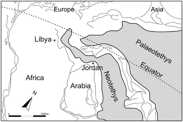
Permo-Triassic paleogeographic map of the Middle East illustrating the opening of the Neotethys that was associated with major extensional movements in northern Arabia and Northeast Africa. After Stampfli and Borel (2002). 1500 km (932 mi). From Lüning et al. (2006). From Luning, S., and J. Kuss, 2014, Petroleum geology of Jordan, in L. Marlow, C. Kendall, and L. Yose, eds., Petroleum systems of the Tethyan region: AAPG Memoir 106, p. 217-239.
File history
Click on a date/time to view the file as it appeared at that time.
| Date/Time | Thumbnail | Dimensions | User | Comment | |
|---|---|---|---|---|---|
| current | 21:06, 18 April 2016 | | 700 × 468 (49 KB) | Molyneux (talk | contribs) | Permo-Triassic paleogeographic map of the Middle East illustrating the opening of the Neotethys that was associated with major extensional movements in northern Arabia and Northeast Africa. After Stampfli and Borel (2002). 1500 km (932 mi). From Lünin... |
You cannot overwrite this file.
File usage
The following page uses this file: