File:M106Ch13Fig11.jpg
Jump to navigation
Jump to search
Size of this preview: 659 × 600 pixels. Other resolutions: 264 × 240 pixels | 700 × 637 pixels.
Original file (700 × 637 pixels, file size: 109 KB, MIME type: image/jpeg)
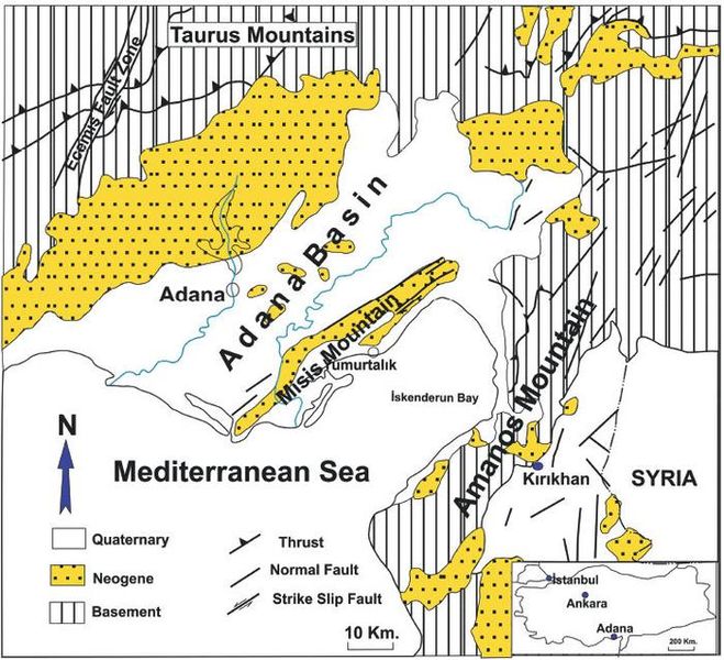
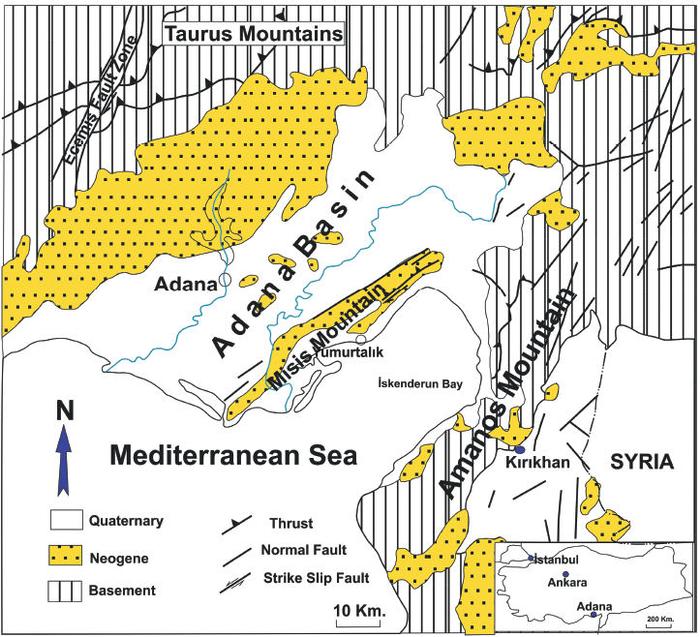
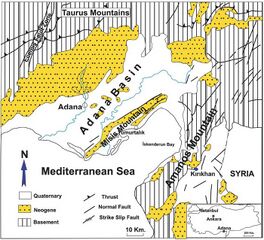
Simplified geological map of the Adana Neogene Basin. Misis structural trend divides the basin into two parts: Adana and İskenderun subbasins (redrawn from Derman and Gürbüz, 2007). 10 km (6.2 mi). From Derman, Ahmet Sami, 2014, Petroleum systems of Turkish Basins, in L. Marlow, C. Kendall, and L. Yose, eds., Petroleum systems of the Tethyan region: AAPG Memoir 106, p. 469-504.
File history
Click on a date/time to view the file as it appeared at that time.
| Date/Time | Thumbnail | Dimensions | User | Comment | |
|---|---|---|---|---|---|
| current | 20:03, 5 July 2016 | | 700 × 637 (109 KB) | Molyneux (talk | contribs) | Simplified geological map of the Adana Neogene Basin. Misis structural trend divides the basin into two parts: Adana and İskenderun subbasins (redrawn from Derman and Gürbüz, 2007). 10 km (6.2 mi). From Derman, Ahmet Sami, 2014, Petroleum systems of... |
You cannot overwrite this file.
File usage
The following page uses this file: