File:Mapping-with-two-dimensional-seismic-data fig3.png
Jump to navigation
Jump to search

Size of this preview: 488 × 599 pixels. Other resolutions: 195 × 240 pixels | 885 × 1,087 pixels.
Original file (885 × 1,087 pixels, file size: 41 KB, MIME type: image/png)
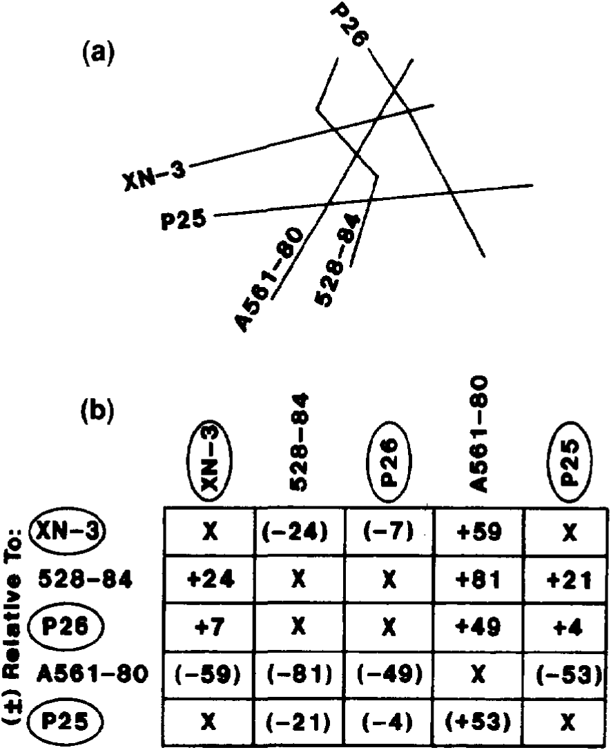
Illustration showing effect of lateral differences in velocity on conversion of time and depth. If a single velocity function of 8300 ft/sec were used, errors of +6 ft at A and -440 ft at B would appear on the depth map.
File history
Click on a date/time to view the file as it appeared at that time.
| Date/Time | Thumbnail | Dimensions | User | Comment | |
|---|---|---|---|---|---|
| current | 19:36, 14 January 2014 | | 885 × 1,087 (41 KB) | Importer (talk | contribs) | Illustration showing effect of lateral differences in velocity on conversion of time and depth. If a single velocity function of 8300 ft/sec were used, errors of +6 ft at A and -440 ft at B would appear on the depth map. Category:Geophysical methods |
You cannot overwrite this file.
File usage
The following page uses this file: