File:Mth14ch02f07.jpg
Mth14ch02f07.jpg (700 × 449 pixels, file size: 53 KB, MIME type: image/jpeg)
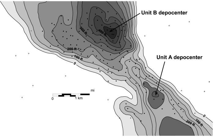
Gross-sandstone isopach map of the Yowlumne sandstone showing separate depocenter thicks in Units A and B. The different depocenters indicate that the units may represent separate depositional accumulations, an interpretation consistent with Units A and B representing separate compartments with different oil-water contacts. From M. S. Clark, R. K. Prather, J. D. Melvin, 2003, Characterization and Exploitation of the Distal Margin of a Fan-shaped Turbidite Reservoir--The ARCO-DOE 91X-3 Horizontal Well Project, Yowlumne Field, San Joaquin Basin, California in AAPG Methods in Exploration No. 14: Horizontal Wells: Focus on the Reservoir, Edited by T. R. Carr, E. P. Mason, and C. T. Feazel.
File history
Click on a date/time to view the file as it appeared at that time.
| Date/Time | Thumbnail | Dimensions | User | Comment | |
|---|---|---|---|---|---|
| current | 19:56, 4 December 2015 | | 700 × 449 (53 KB) | Molyneux (talk | contribs) | Gross-sandstone isopach map of the Yowlumne sandstone showing separate depocenter thicks in Units A and B. The different depocenters indicate that the units may represent separate depositional accumulations, an interpretation consistent with Units A an... |
You cannot overwrite this file.
File usage
The following page uses this file: