Search results
Jump to navigation
Jump to search
There is a page named "Dip" on this wiki. See also the other search results found.
File:Conversion-of-well-log-data-to-subsurface-stratigraphic-and-structural-information fig6.png ...urface and apparent dip of that surface in a plane at an angle of ε to the dip direction.(907 × 1,090 (57 KB)) - 16:38, 14 January 2014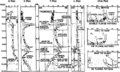
File:Evaluating-structurally-complex-reservoirs fig1.png ...plot), dip versus depth in the direction of least curvature (L plot), and dip versus azimuth (DVA plot). (From Bengtsen, 1982.)(1,933 × 1,167 (174 KB)) - 18:47, 14 January 2014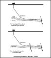
File:M91Figure163.JPG ...e geosteered through a target zone by assuming the bed dip. If the assumed dip is wrong, the well may exit the target zone. Problems also occur if the wel(600 × 693 (39 KB)) - 19:49, 30 July 2014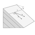
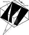
File:Dip.svg.png Strike and Dip. From Wikipedia, author Eurico Zimbres.(429 × 425 (34 KB)) - 19:21, 7 March 2014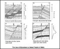
File:M91Ch13FG80.JPG ...an indicate that a fault is present. Drag patterns may also be seen on the dip data above and below the fault intersection in a well (from Schlumberger, 1(800 × 660 (102 KB)) - 21:14, 29 April 2015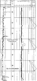
File:Dipmeters fig4.png Dip data expressed on a standard arrow plot.(952 × 2,099 (121 KB)) - 01:19, 14 January 2014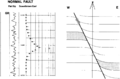
File:Dipmeters fig5.png Simple dip model for the description of a normal fault with drag.(1,745 × 1,150 (71 KB)) - 01:19, 14 January 2014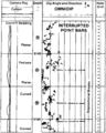
File:Dipmeters fig7.png Field example of a detailed dip computation through a sequence of interrupted meandering stream point bars.(955 × 1,189 (73 KB)) - 01:19, 14 January 2014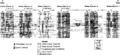
File:Evaluating-tight-gas-reservoirs fig2.png The depositional dip-oriented cross section through the Frontier Formation, Moxa arch area, Wyom(2,723 × 1,238 (164 KB)) - 18:47, 14 January 2014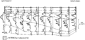
File:Lithofacies-and-environmental-analysis-of-clastic-depositional-systems fig2.png Gamma ray correlation (dip section) of a series of prograding shoreface sandstones. Note the imbricate(943 × 448 (16 KB)) - 21:36, 13 January 2014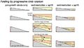
File:ST53Part01Pg12B.jpg ...sively rotated with each increment of folding. Thus, older growth horizons dip more steeply than do younger horizons, yielding a pronounced fanning of lim(750 × 431 (84 KB)) - 16:59, 28 July 2015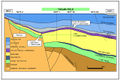
File:M115CH11FG04.jpg ...ustrating the Thelma free water level relative to the independent four-way dip closure and the requirement for an additional trapping mechanism (line of s(1,277 × 860 (520 KB)) - 15:21, 22 January 2019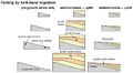
File:ST53Part01Pg12A.jpg ...nk-band migration, fold limbs widen through time while maintaining a fixed dip (Suppe et al., 1992), as illustrated in the sequential model involving pre- ...ta is equal to dip of the fold limb in pre-growth strata. The width of the dip panel for each growth horizon corresponds to the amount of fold growth that(750 × 411 (83 KB)) - 16:36, 28 July 2015
File:Evaluating-structurally-complex-reservoirs fig3.png ...r data and projected away from the wellbore. Isogons are contours of equal dip (see Ramsay, 1967) and can constrain the shapes of folds in section. (From(942 × 1,424 (112 KB)) - 18:47, 14 January 2014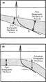
File:Conversion-of-well-log-data-to-subsurface-stratigraphic-and-structural-information fig7.png ...large in relation to the downdip deviation of the well path. (b) Change in dip produces an error in estimation of the true stratigraphic thickness.(950 × 1,693 (94 KB)) - 16:38, 14 January 2014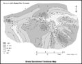
File:M91Ch11FG71.JPG A gross sandstone thickness map can give an idea of the depositional dip and strike of the sedimentary system. In the Budare field of Venezuela, nor(800 × 629 (79 KB)) - 15:48, 27 April 2015


