File:1.png
Jump to navigation
Jump to search
No higher resolution available.
1.png (398 × 552 pixels, file size: 187 KB, MIME type: image/png)
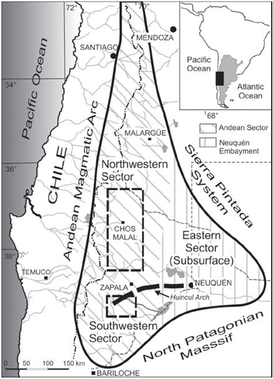
Figure 1. General map of the Neuquén Basin showing the location of main sites. Based on Spalletti & Veiga (2007).
File history
Click on a date/time to view the file as it appeared at that time.
| Date/Time | Thumbnail | Dimensions | User | Comment | |
|---|---|---|---|---|---|
| current | 16:45, 26 June 2015 | | 398 × 552 (187 KB) | Aguscanale (talk | contribs) | Figure 1. General map of the Neuquén Basin showing the location of main sites. Based on Spalletti & Veiga (2007). |
You cannot overwrite this file.
File usage
The following page uses this file: