File:M31F24.jpg
Jump to navigation
Jump to search

Size of this preview: 480 × 600 pixels. Other resolutions: 192 × 240 pixels | 758 × 947 pixels.
Original file (758 × 947 pixels, file size: 524 KB, MIME type: image/jpeg)
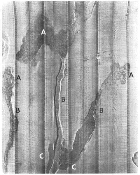
Side-scan sonar mosaic of subaqueous landslide gullies in the Mississippi River delta. The width of the mosaic is 1.5 km, and the superimposed grid is a 25-m square. The slope is from top (approximately 10-m water depth) to bottom (water depth 60 m). Coleman, J. M., and D. B. Prior, 1981, Deltaic environments of deposition in P. A. Scholle and D. Spearing, eds., Sandstone depositional environments: AAPG Memoir 31, p. 139-178.
File history
Click on a date/time to view the file as it appeared at that time.
| Date/Time | Thumbnail | Dimensions | User | Comment | |
|---|---|---|---|---|---|
| current | 18:21, 18 August 2014 | | 758 × 947 (524 KB) | Molyneux (talk | contribs) | Side-scan sonar mosaic of subaqueous landslide gullies in the Mississippi River delta. The width of the mosaic is 1.5 km, and the superimposed grid is a 25-m square. The slope is from top (approximately 10-m water depth) to bottom (water depth 60 m). C... |
You cannot overwrite this file.
File usage
The following page uses this file: