File:M91FG117.JPG
Jump to navigation
Jump to search

Size of this preview: 696 × 599 pixels. Other resolutions: 279 × 240 pixels | 800 × 689 pixels.
Original file (800 × 689 pixels, file size: 66 KB, MIME type: image/jpeg)
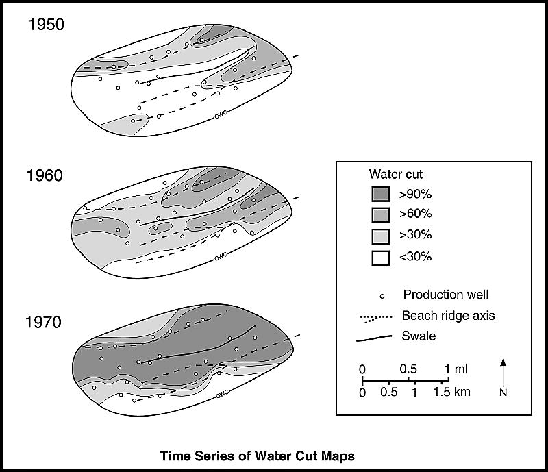
Time series of water cut maps from the West Cornelius reservoir, North Markham-North Bay City field, Texas. In this strand-plain reservoir, east-northeastndashwest-southwest-oriented beach ridge macroforms are fairways for water ingress. Tidal mud flat deposits south of the field restrict water influx from this direction (from Tyler and Ambrose, 1986). Reprinted with permission from the AAPG.
File history
Click on a date/time to view the file as it appeared at that time.
| Date/Time | Thumbnail | Dimensions | User | Comment | |
|---|---|---|---|---|---|
| current | 21:32, 12 August 2015 | | 800 × 689 (66 KB) | Cwhitehurst (talk | contribs) | Time series of water cut maps from the West Cornelius reservoir, North Markham-North Bay City field, Texas. In this strand-plain reservoir, east-northeastndashwest-southwest-oriented beach ridge macroforms are fairways for water ingress. Tidal mud flat... |
You cannot overwrite this file.
File usage
The following page uses this file: