File:Seismic-inversion fig6.png
Jump to navigation
Jump to search

Size of this preview: 800 × 478 pixels. Other resolutions: 320 × 191 pixels | 2,045 × 1,222 pixels.
Original file (2,045 × 1,222 pixels, file size: 1.56 MB, MIME type: image/png)
Copyright of: Western Geophysical
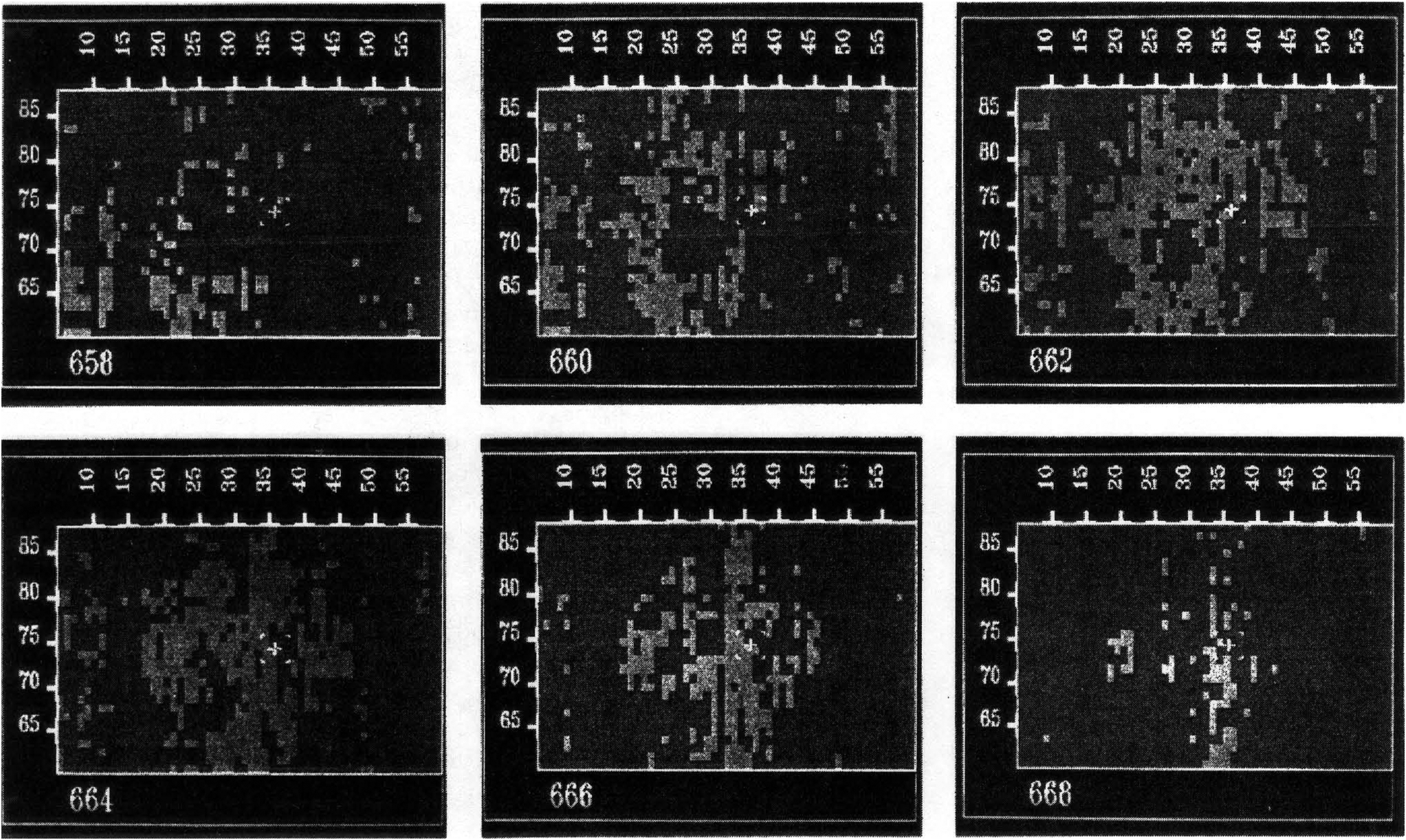
Time slice displays through the 3-D survey of the river channel zone. The lightly shaded areas show low velocity material in which reservoir sands are present. Copyright: Western Geophysical.
File history
Click on a date/time to view the file as it appeared at that time.
| Date/Time | Thumbnail | Dimensions | User | Comment | |
|---|---|---|---|---|---|
| current | 19:34, 14 January 2014 | | 2,045 × 1,222 (1.56 MB) | Importer (talk | contribs) | {{copyright|Western Geophysical}} Time slice displays through the 3-D survey of the river channel zone. The lightly shaded areas show low velocity material in which reservoir sands are present. Copyright: Western Geophysical. [[Category:Geophysical m... |
You cannot overwrite this file.
File usage
The following page uses this file: