File:GiacomoneEtAlFigure1.jpg
Jump to navigation
Jump to search
Size of this preview: 800 × 553 pixels. Other resolutions: 320 × 221 pixels | 868 × 600 pixels.
Original file (868 × 600 pixels, file size: 145 KB, MIME type: image/jpeg)
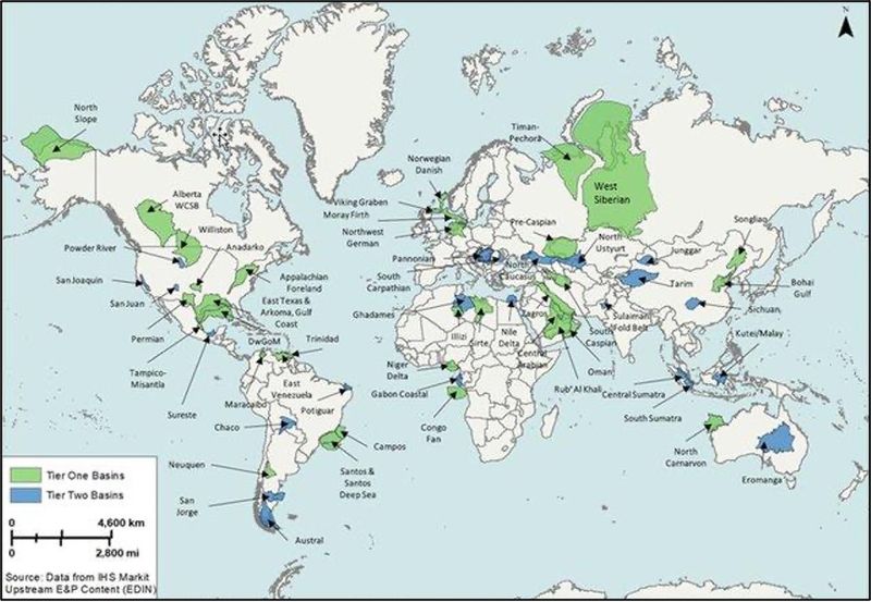
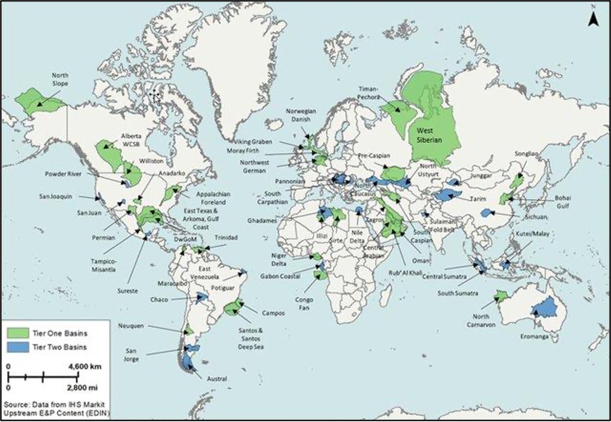
Location map of world’s super basins. 31 tier one global super basins (those with more than 5 billion BOE of cumulative production and remaining recoverable oil and gas) are shown in green. Tier two super basins (those with less than 5 billion BOE of cumulative production or remaining recoverable oil and gas) are shown in light blue. DwGoM = deep-water Gulf of Mexico; E&P = exploration and production; WCSB = Western Canada Sedimentary Basin. [1]
File history
Click on a date/time to view the file as it appeared at that time.
| Date/Time | Thumbnail | Dimensions | User | Comment | |
|---|---|---|---|---|---|
| current | 20:51, 28 October 2021 | | 868 × 600 (145 KB) | Molyneux (talk | contribs) | Location map of world’s super basins. 31 tier one global super basins (those with more than 5 billion BOE of cumulative production and remaining recoverable oil and gas) are shown in green. Tier two super basins (those with less than 5 billion BOE o... |
You cannot overwrite this file.
File usage
The following page uses this file: