File:M91Ch13FG87.JPG
Jump to navigation
Jump to search
No higher resolution available.
M91Ch13FG87.JPG (600 × 396 pixels, file size: 78 KB, MIME type: image/jpeg)
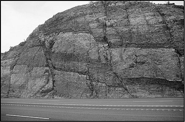
Fault damage zone from Moab, Utah. The outcrop is about 15 m (49 ft) high (photo courtesy of Angus MacLellan). From Shepherd, M., 2009, Structural geology: Faults, in M. Shepherd, Oil field production geology: AAPG Memoir 91, p. 107-122.
File history
Click on a date/time to view the file as it appeared at that time.
| Date/Time | Thumbnail | Dimensions | User | Comment | |
|---|---|---|---|---|---|
| current | 21:36, 29 April 2015 | | 600 × 396 (78 KB) | Molyneux (talk | contribs) | Fault damage zone from Moab, Utah. The outcrop is about 15 m (49 ft) high (photo courtesy of Angus MacLellan). From Shepherd, M., 2009, Structural geology: Faults, in M. Shepherd, Oil field production geology: AAPG Memoir 91, p. 107-122. |
You cannot overwrite this file.
File usage
The following page uses this file: