File:Mth14ch04f03.jpg
Jump to navigation
Jump to search
No higher resolution available.
Mth14ch04f03.jpg (500 × 495 pixels, file size: 47 KB, MIME type: image/jpeg)
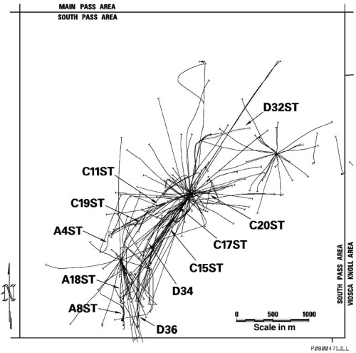
South Pass 62 field base map. Eleven horizontal wells and sidetracks were drilled between 1993 and 1997. From Results and Conclusions of a Horizontal-drilling Program at South Pass 62 Salt-dome Field, by E. P. Mason, M. J. Bastian, R. Detomo, M. N. Hashem, and A. J. Hildebrandt, Pages 49 - 65, in AAPG Methods in Exploration No. 14: Horizontal Wells: Focus on the Reservoir, Edited by T. R. Carr, E. P. Mason, and C. T. Feazel.
File history
Click on a date/time to view the file as it appeared at that time.
| Date/Time | Thumbnail | Dimensions | User | Comment | |
|---|---|---|---|---|---|
| current | 16:09, 7 December 2015 | | 500 × 495 (47 KB) | Molyneux (talk | contribs) | South Pass 62 field base map. Eleven horizontal wells and sidetracks were drilled between 1993 and 1997. From Results and Conclusions of a Horizontal-drilling Program at South Pass 62 Salt-dome Field, by E. P. Mason, M. J. Bastian, R. Detomo, M. N. Has... |
You cannot overwrite this file.
File usage
The following page uses this file: