Diapir
Jump to navigation
Jump to search
Useful links
References
- ↑ O'Neill, C. A., 1973, Evolution of Belle Isle salt dome, Louisiana: Gulf Coast Association of Geological Societies Transactions, v. 23, p. 115–135.
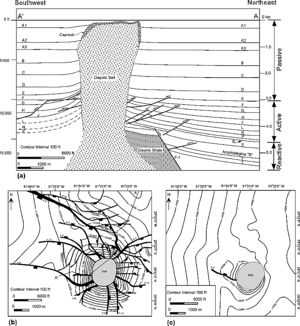
- ↑ Yin, H. and R. H. Groshong Jr., 2007, A three-dimensional kinematic model for the deformation above an active diapir: AAPG Bulletin, V. 91, p. 343-363.
This article is a stub. You can help AAPG Wiki by expanding it.
