File:1024px-Northern Gulf of Mexico map.png
Jump to navigation
Jump to search

Size of this preview: 800 × 486 pixels. Other resolutions: 320 × 194 pixels | 1,024 × 622 pixels.
Original file (1,024 × 622 pixels, file size: 421 KB, MIME type: image/png)
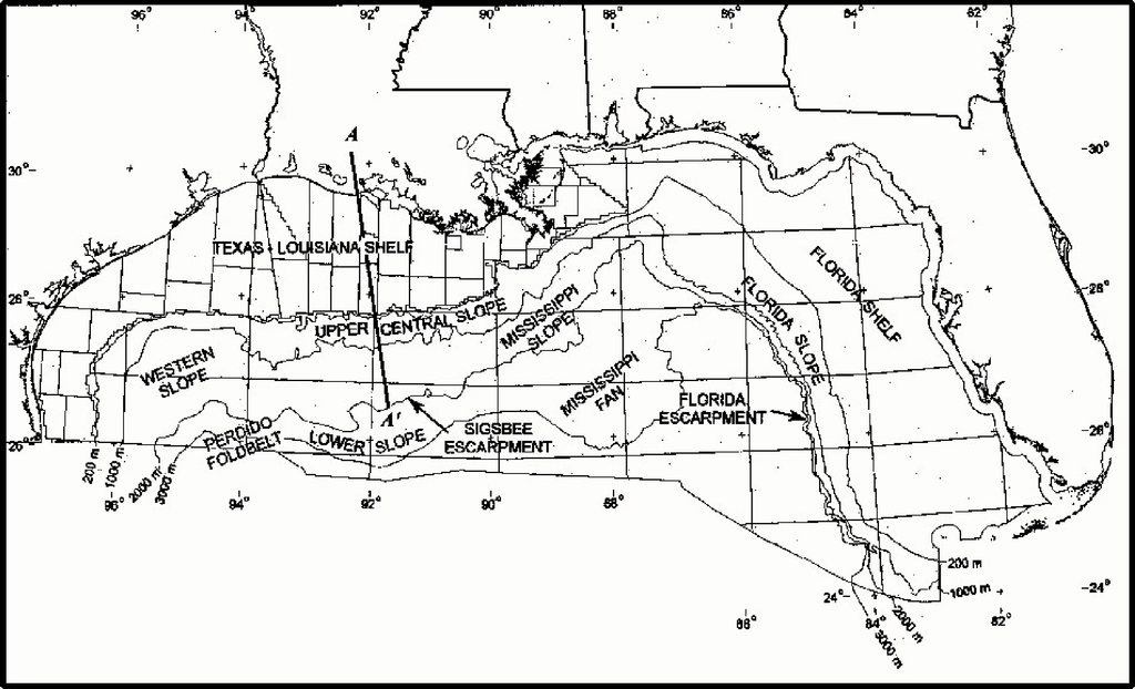
Map of northern part of Gulf of Mexico. Major physiogeographic features of the northern part of Gulf of Mexico outer continental shelf. Minerals Management Service. Gulf of Mexico OCS Region. (May 2000).
File history
Click on a date/time to view the file as it appeared at that time.
| Date/Time | Thumbnail | Dimensions | User | Comment | |
|---|---|---|---|---|---|
| current | 17:22, 23 December 2014 | | 1,024 × 622 (421 KB) | Molyneux (talk | contribs) | Map of northern part of Gulf of Mexico. Major physiogeographic features of the northern part of Gulf of Mexico outer continental shelf. Minerals Management Service. Gulf of Mexico OCS Region. (May 2000). |
You cannot overwrite this file.
File usage
There are no pages that use this file.