File:DiapirDiagram.JPG
Jump to navigation
Jump to search

Size of this preview: 551 × 599 pixels. Other resolutions: 221 × 240 pixels | 800 × 870 pixels.
Original file (800 × 870 pixels, file size: 270 KB, MIME type: image/jpeg)
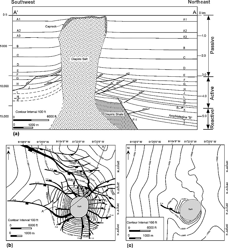
Belle Isle salt dome, Louisiana (modified from O'Neill, 1973). (a) Cross section (letters A1ndashZ represent the stratigraphic unit boundaries). Location given in (b). (b) Structure contour map drawn on the J horizon. (c) Structure contour map drawn on the B horizon. From AAPG Bulletin, V. 91, No. 3 (March 2007), P. 343-363, by Hongwei Yin and Richard H. Groshong Jr.
File history
Click on a date/time to view the file as it appeared at that time.
| Date/Time | Thumbnail | Dimensions | User | Comment | |
|---|---|---|---|---|---|
| current | 17:59, 2 January 2015 | | 800 × 870 (270 KB) | Molyneux (talk | contribs) | Belle Isle salt dome, Louisiana (modified from O'Neill, 1973). (a) Cross section (letters A1ndashZ represent the stratigraphic unit boundaries). Location given in (b). (b) Structure contour map drawn on the J horizon. (c) Structure contour map drawn on... |
You cannot overwrite this file.
File usage
The following page uses this file: