File:Evaluating-structurally-complex-reservoirs fig6.png
Jump to navigation
Jump to search

Size of this preview: 440 × 599 pixels. Other resolutions: 176 × 240 pixels | 1,840 × 2,504 pixels.
Original file (1,840 × 2,504 pixels, file size: 315 KB, MIME type: image/png)
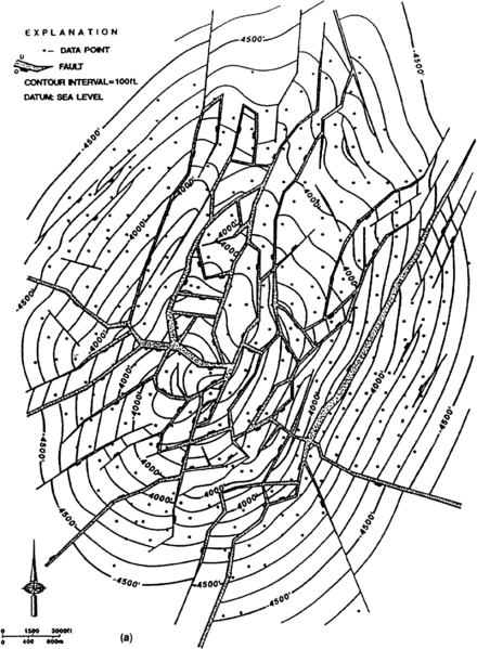
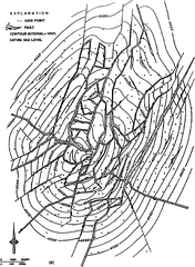
(a) Structure map and (b) (next page) restored structure map showing fault gaps removed. Remaining gaps and overlaps in the restored faults represent geometric incompatibilities in the interpretation. (From Galloway et al., 1983.)
File history
Click on a date/time to view the file as it appeared at that time.
| Date/Time | Thumbnail | Dimensions | User | Comment | |
|---|---|---|---|---|---|
| current | 18:47, 14 January 2014 | | 1,840 × 2,504 (315 KB) | Importer (talk | contribs) | (a) Structure map and (b) (next page) restored structure map showing fault gaps removed. Remaining gaps and overlaps in the restored faults represent geometric incompatibilities in the interpretation. (From Galloway et al., 1983.) [[Category:Geologica... |
You cannot overwrite this file.
File usage
The following page uses this file: