Uploads by Andreas.grings
Jump to navigation
Jump to search
This special page shows all uploaded files.
| Date | Name | Thumbnail | Size | Description | Versions |
|---|---|---|---|---|---|
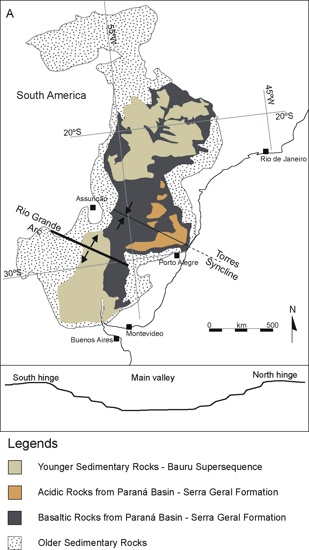
| 13:40, 25 June 2015 | Parana-Etendeka 2.jpg (file) |  |
478 KB | Distribution of magmatic and sedimentary rocks of the Parana Basin, from (Rossetti et al., 2014). | 1 |
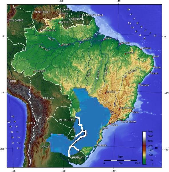
| 17:42, 24 June 2015 | Parana 2.jpg (file) |  |
108 KB | The Guarani Aquifer Location. | 1 |
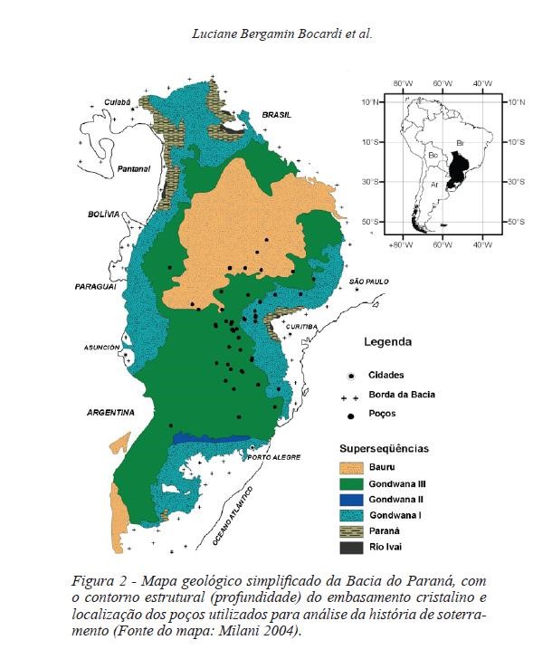
| 17:38, 24 June 2015 | Parana 1.jpg (file) |  |
86 KB | Geological Map of the Paraná Basin. Milani E. J. 2004. | 1 |
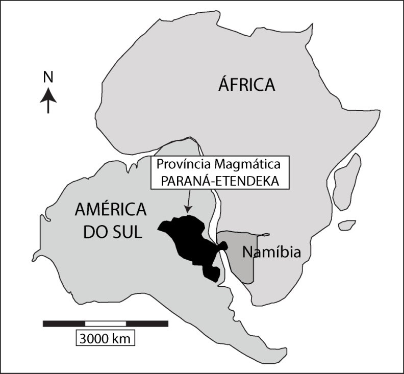
| 16:43, 24 June 2015 | Parana-Etendeka 1.jpg (file) |  |
63 KB | Location of the Parana-Etendeka CBP modified from Jerram, 2002. | 1 |
| 16:32, 24 June 2015 | Guara 05.jpg (file) |  |
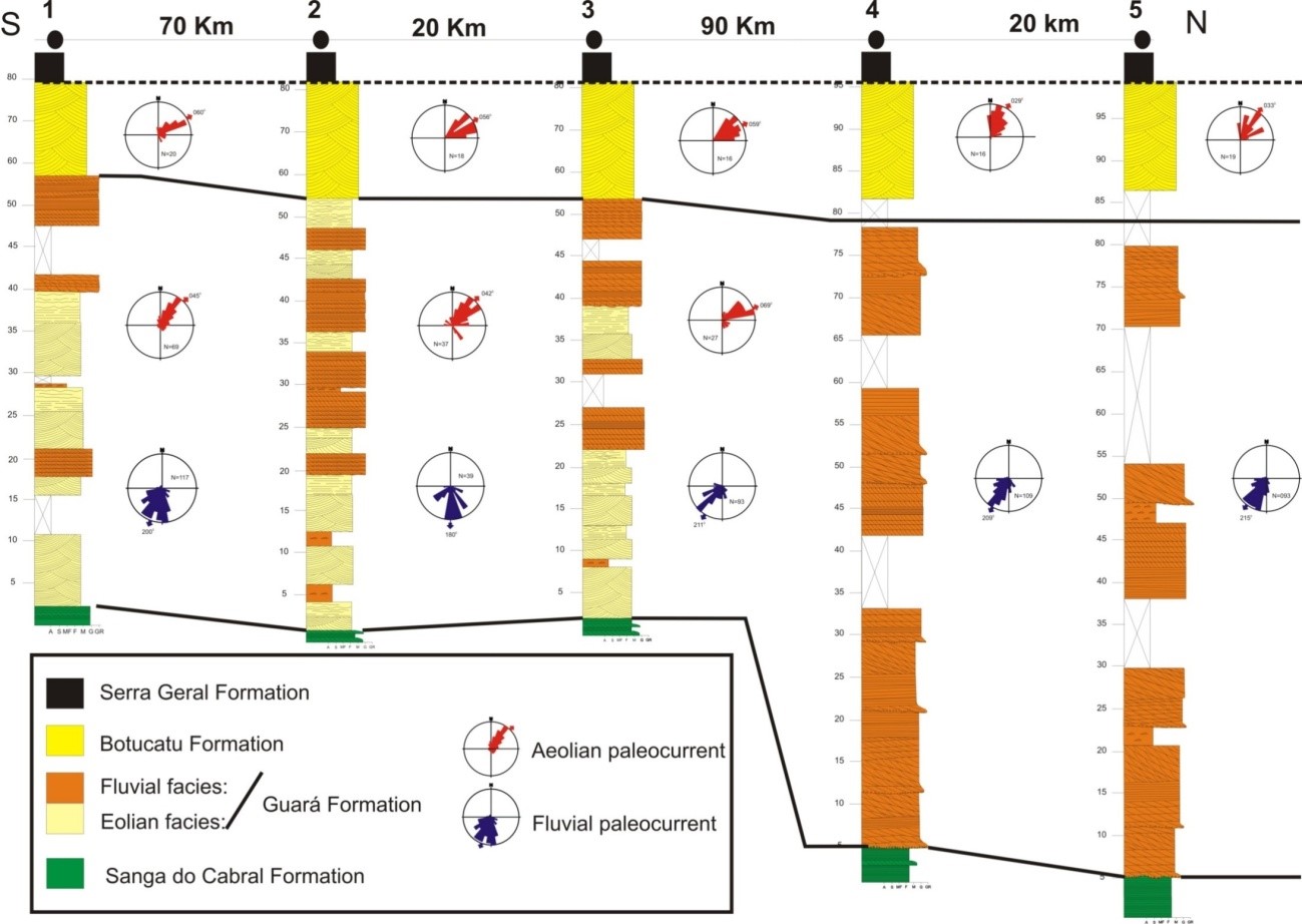
172 KB | Stratigraphic correlation of Botucatu and Guará Formation in western Rio Grande do Sul (Brazil). Note the absence of aeolian facies in the northern portion of Guará Formation. (Scherer & Lavina, 2006) | 1 |
| 16:32, 24 June 2015 | Guara 04.jpg (file) |  |
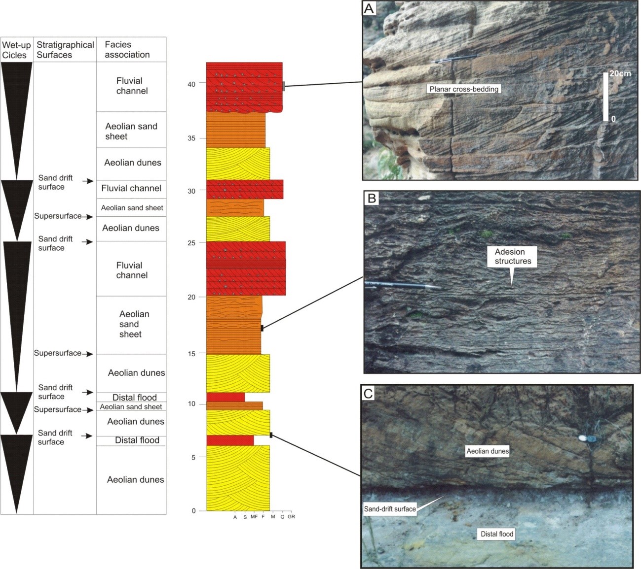
362 KB | Vertical log of Guará Formation near the Brazil-Uruguay frontier, showning facies examples for the fluvio-eolian system. | 1 |
| 16:31, 24 June 2015 | Guara 03.jpg (file) |  |
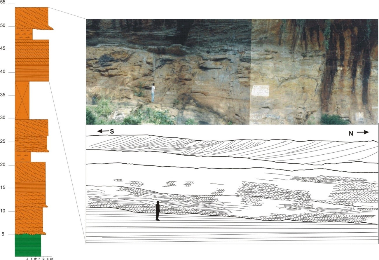
267 KB | Vertical log and section showing the fluvial facies of Guará Formation northern portion. | 1 |
| 16:19, 24 June 2015 | Guara 02.jpg (file) |  |
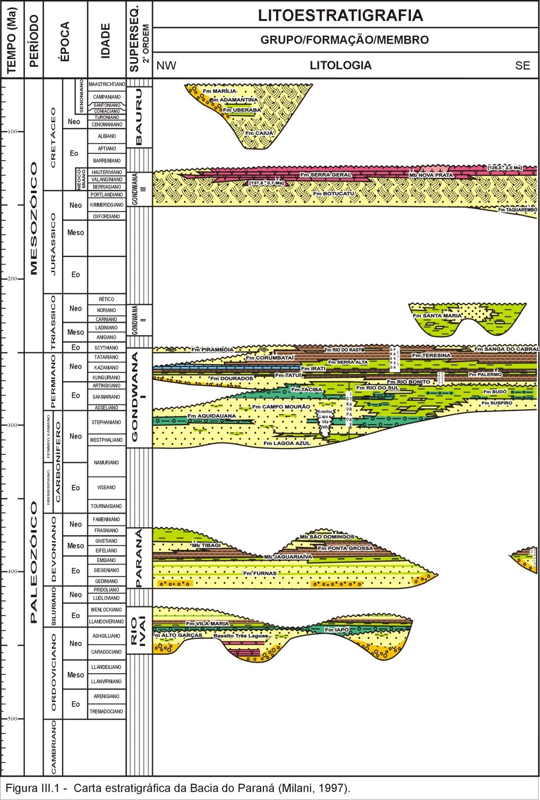
427 KB | Stratigraphic diagram of Paraná Basin. Fm. Taquarembó is the Guará Formation correlate in Uruguay (from Milani, 1997) | 1 |
| 16:14, 24 June 2015 | Guara 01.jpg (file) |  |
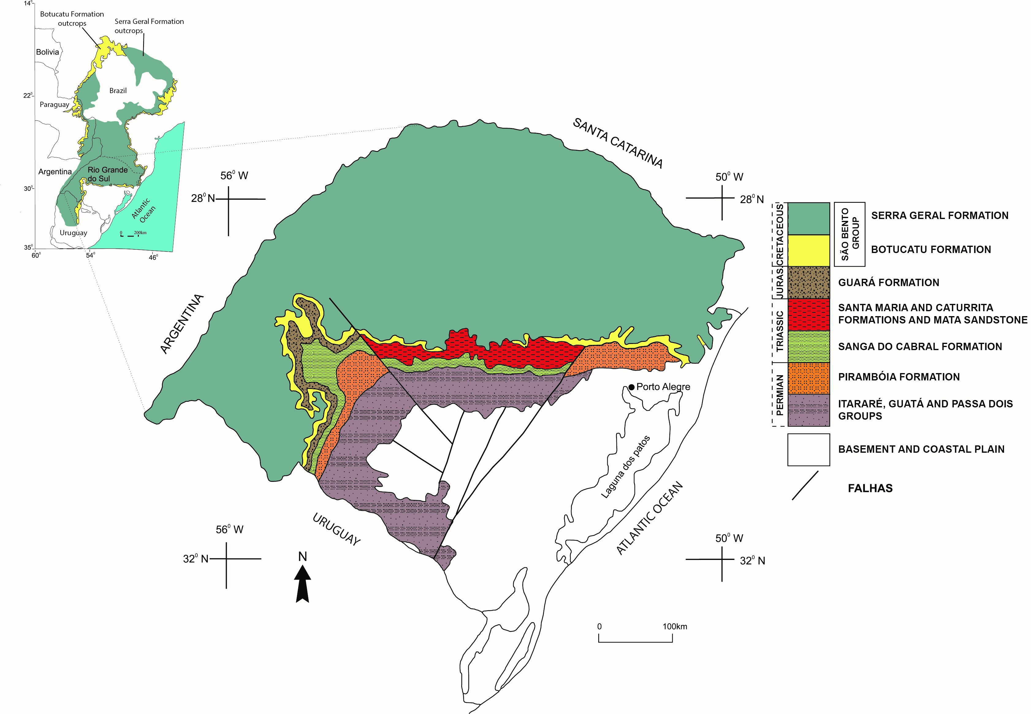
1.18 MB | Simplified geological map of Paraná Basin in Rio Grande do Sul state, Brazil. (modified from Scherer & Lavina, 2005) | 1 |
| 15:53, 24 June 2015 | Botucatu 2.jpg (file) |  |
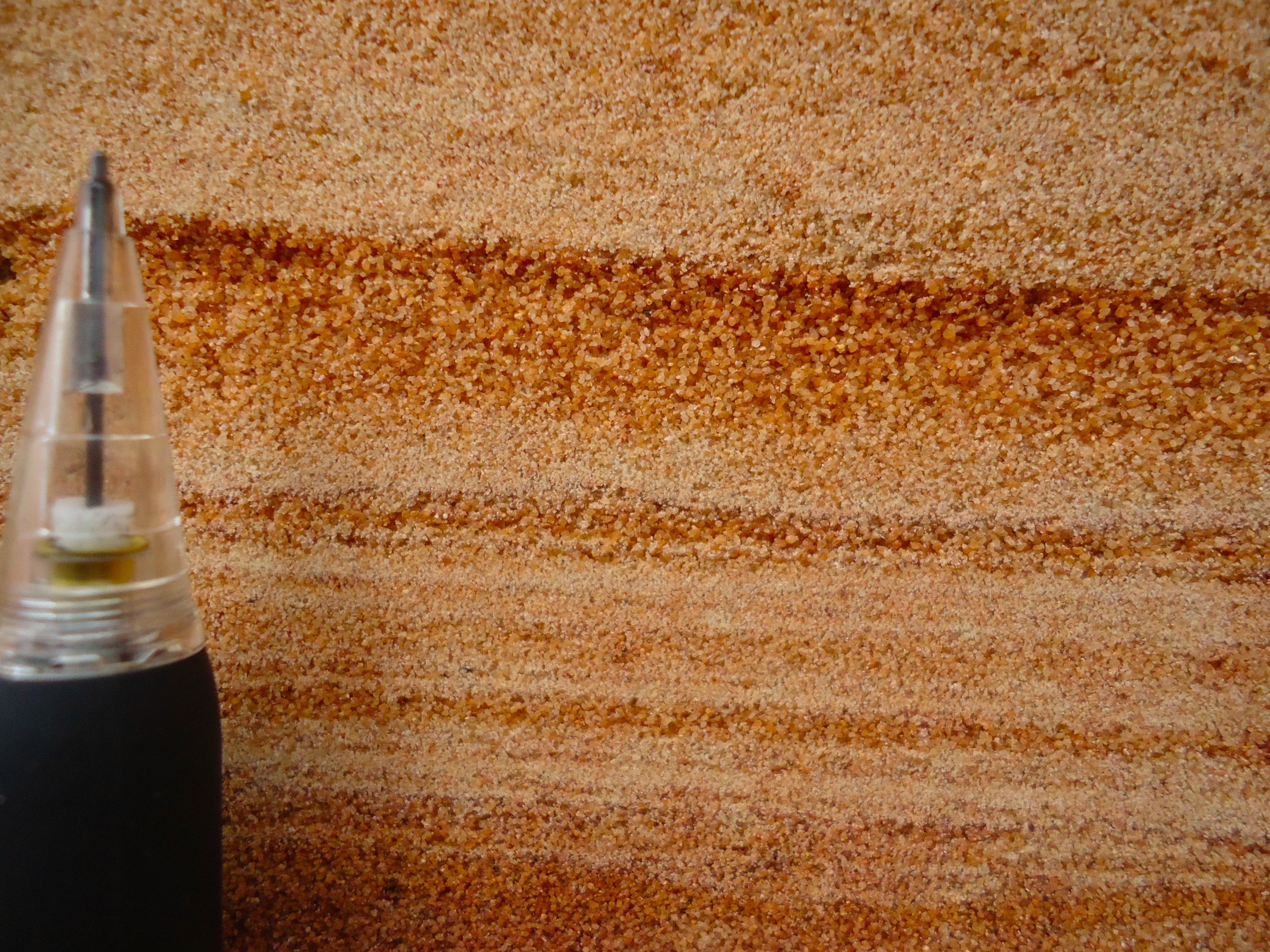
1.48 MB | Inverse grading in the Botucatu Formation in Uruguay | 1 |
| 15:53, 24 June 2015 | Botucatu 1.jpg (file) |  |
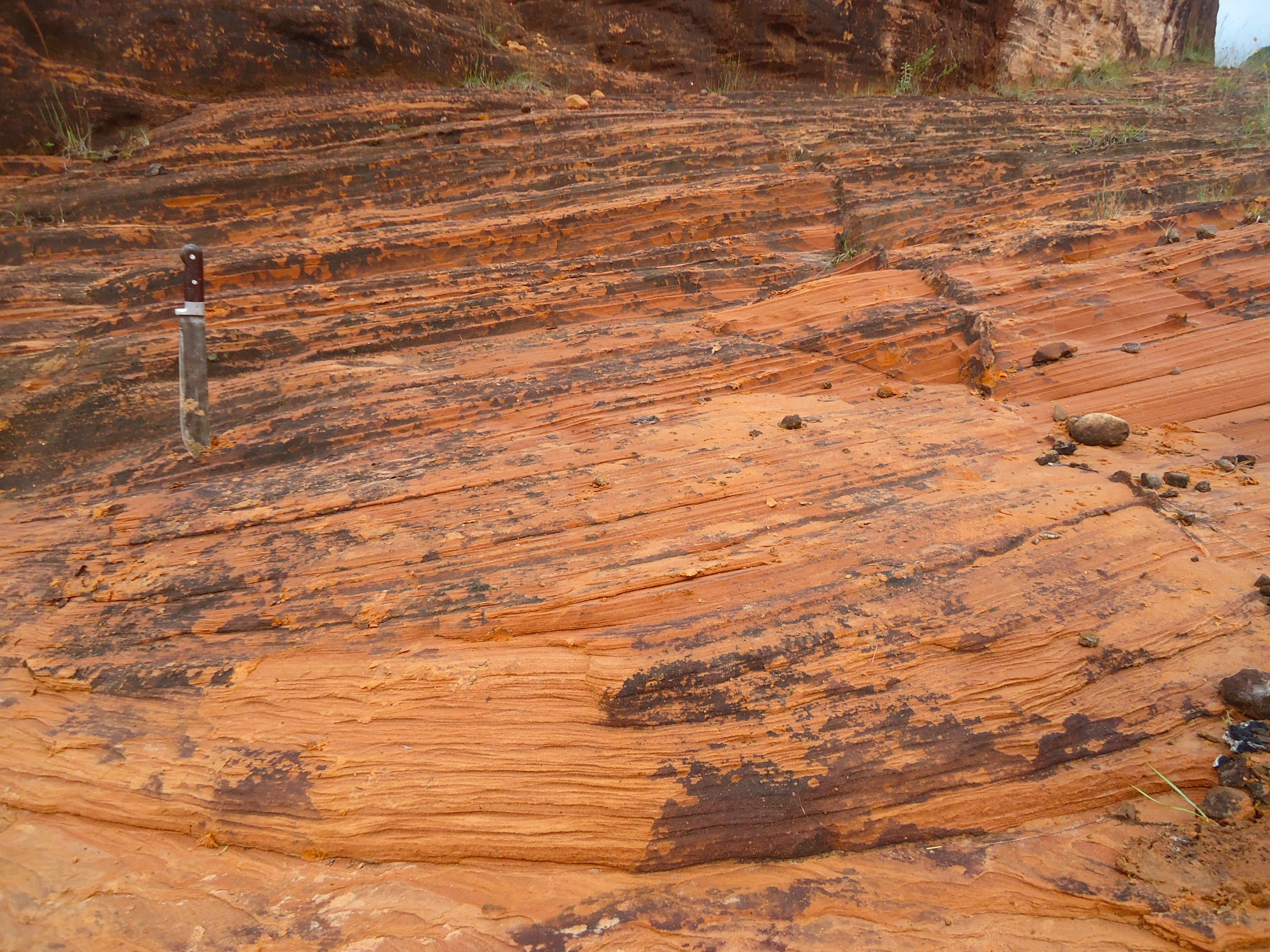
1.48 MB | Large-scale of cross strata structure in the Botucatu Formation in Uruguay | 1 |
| 13:45, 24 June 2015 | Sedimentary cycles of Irati Formation .png (file) |  |
423 KB | Sedimentary cycles of Irati Formation (Milani E. J., et al, 2007a) | 1 |
| 13:34, 24 June 2015 | Paleogeographic setting of the restricted Irati-Whitehill Sea.jpg (file) |  |
187 KB | Paleogeographic setting of the restricted Irati-Whitehill Sea (Milani E.J., et al. , 2007a) | 1 |