Difference between revisions of "File:M91Ch11FG72.JPG"
Jump to navigation
Jump to search
(Log facies maps show the bedding configuration within the reservoir interval. The log patterns are then related to the lithofacies scheme and can be used to define lithofacies maps. This example is from the Budare field of Venezuela (from Hamilton et a...) |
(No difference)
|
Latest revision as of 15:51, 27 April 2015
Log facies maps show the bedding configuration within the reservoir interval. The log patterns are then related to the lithofacies scheme and can be used to define lithofacies maps. This example is from the Budare field of Venezuela (from Hamilton et al., 2002). Reprinted with permission from the AAPG. SP = spontaneous potential log; GR = gamma-ray log. Shepherd, M., 2009, Lithofacies maps, in M. Shepherd, Oil field production geology: AAPG Memoir 91, p. 93-98.
File history
Click on a date/time to view the file as it appeared at that time.
| Date/Time | Thumbnail | Dimensions | User | Comment | |
|---|---|---|---|---|---|
| current | 15:51, 27 April 2015 | 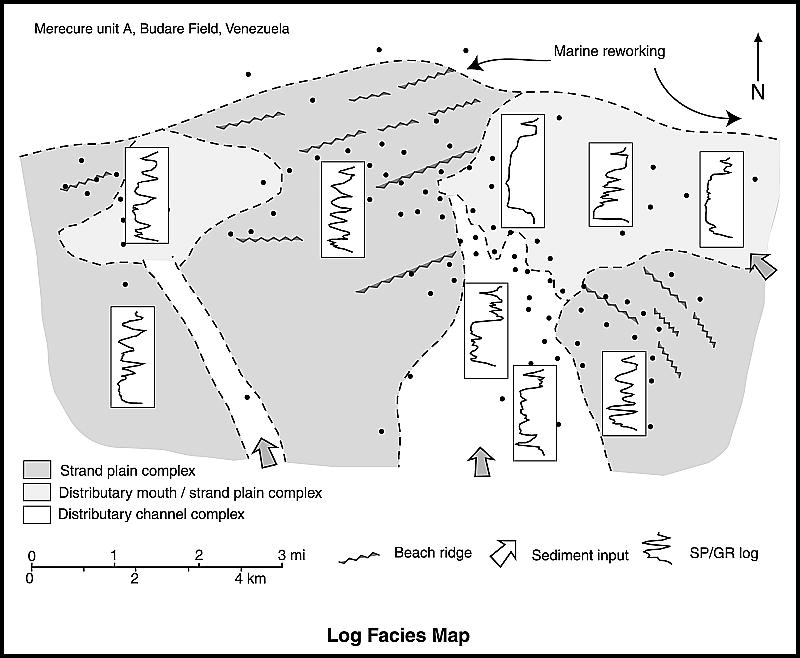 | 800 × 658 (69 KB) | Molyneux (talk | contribs) | Log facies maps show the bedding configuration within the reservoir interval. The log patterns are then related to the lithofacies scheme and can be used to define lithofacies maps. This example is from the Budare field of Venezuela (from Hamilton et a... |
You cannot overwrite this file.
File usage
The following page uses this file: