Difference between revisions of "File:GiacomoneEtAlFigure4.jpg"
Jump to navigation
Jump to search
(Location map of the United States (northern) Gulf of Mexico Super Basin.) |
(No difference)
|
Latest revision as of 19:58, 29 October 2021
Location map of the United States (northern) Gulf of Mexico Super Basin.
File history
Click on a date/time to view the file as it appeared at that time.
| Date/Time | Thumbnail | Dimensions | User | Comment | |
|---|---|---|---|---|---|
| current | 19:58, 29 October 2021 | 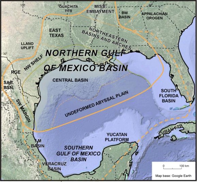 | 678 × 626 (158 KB) | Molyneux (talk | contribs) | Location map of the United States (northern) Gulf of Mexico Super Basin. |
You cannot overwrite this file.
File usage
The following page uses this file: