File:Mth14ch02f01.jpg
Mth14ch02f01.jpg (700 × 457 pixels, file size: 103 KB, MIME type: image/jpeg)
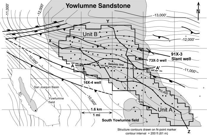
Structure map of Yowlumne field drawn on the N-point marker, a regional correlation horizon that marks the approximate top of the Stevens Sandstone. Note the fanlike shape of the Yowlumne Sandstone and the relationship of Yowlumne Units A and B to the anticlinal closure. From M. S. Clark, R. K. Prather, J. D. Melvin, 2003, Characterization and Exploitation of the Distal Margin of a Fan-shaped Turbidite Reservoir--The ARCO-DOE 91X-3 Horizontal Well Project, Yowlumne Field, San Joaquin Basin, California in AAPG Methods in Exploration No. 14: Horizontal Wells: Focus on the Reservoir, Edited by T. R. Carr, E. P. Mason, and C. T. Feazel.
File history
Click on a date/time to view the file as it appeared at that time.
| Date/Time | Thumbnail | Dimensions | User | Comment | |
|---|---|---|---|---|---|
| current | 23:18, 3 December 2015 | | 700 × 457 (103 KB) | Molyneux (talk | contribs) | Structure map of Yowlumne field drawn on the N-point marker, a regional correlation horizon that marks the approximate top of the Stevens Sandstone. Note the fanlike shape of the Yowlumne Sandstone and the relationship of Yowlumne Units A and B to the ... |
You cannot overwrite this file.
File usage
The following page uses this file: