File:Using-magnetics-in-petroleum-exploration fig14-12.png
Jump to navigation
Jump to search

Size of this preview: 740 × 599 pixels. Other resolutions: 296 × 240 pixels | 1,227 × 994 pixels.
Original file (1,227 × 994 pixels, file size: 1.23 MB, MIME type: image/png)
File history
Click on a date/time to view the file as it appeared at that time.
| Date/Time | Thumbnail | Dimensions | User | Comment | |
|---|---|---|---|---|---|
| current | 22:44, 17 January 2014 | | 1,227 × 994 (1.23 MB) | Matt (talk | contribs) | Correct file |
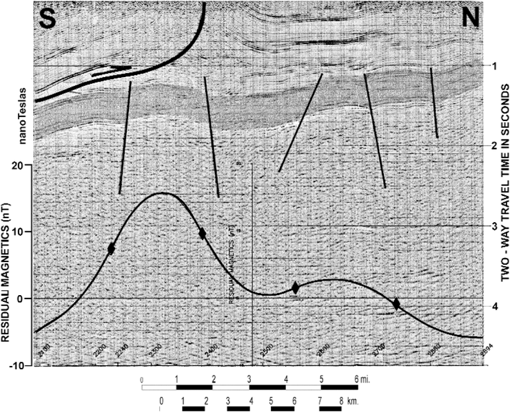
| 21:31, 17 January 2014 |  | 1,391 × 1,004 (248 KB) | Importer (talk | contribs) | Magnetic basement mapping in petroleum exploration can be applied to the search for leads or prospects that can be quickly and economically developed by comparing known traps or structure (and/or stratigraphy) with the basement fault block pattern. Som... |
You cannot overwrite this file.
File usage
The following page uses this file: