File:M91FG179.JPG
Original file (800 × 984 pixels, file size: 103 KB, MIME type: image/jpeg)
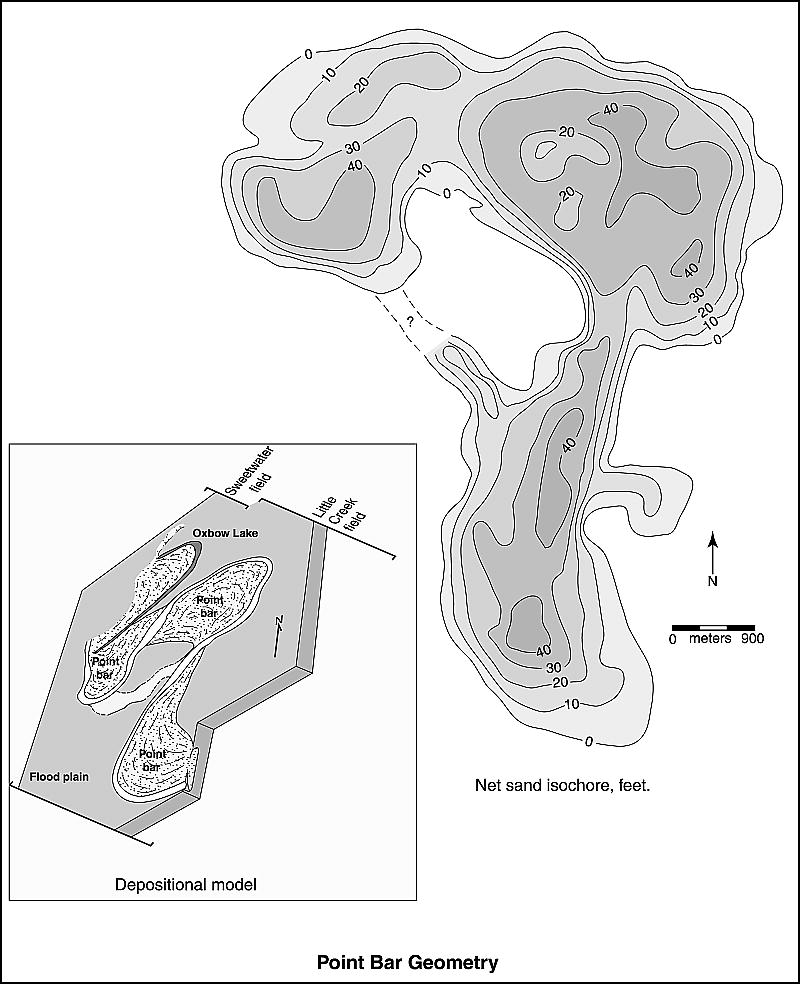
Net sand isochore map of the Q reservoir in the Little Creek field in Mississippi. The reservoir comprises three connected point bar sandstones in a background of floodplain mudstones and siltstones. Just to the north is the Sweetwater field, which produces from a depositionally isolated point bar in the same meander belt system (from Werren et al., 1990). Reprinted with permission from, and © by, Springer Ltd. From Shepherd, M., 2009, Meandering fluvial reservoirs, in M. Shepherd, Oil field production geology: AAPG Memoir 91, p. 261-272.
File history
Click on a date/time to view the file as it appeared at that time.
| Date/Time | Thumbnail | Dimensions | User | Comment | |
|---|---|---|---|---|---|
| current | 21:50, 3 August 2015 | | 800 × 984 (103 KB) | Molyneux (talk | contribs) | Net sand isochore map of the Q reservoir in the Little Creek field in Mississippi. The reservoir comprises three connected point bar sandstones in a background of floodplain mudstones and siltstones. Just to the north is the Sweetwater field, which pro... |
You cannot overwrite this file.
File usage
The following page uses this file: