File:M91FG184.JPG
Revision as of 20:10, 12 August 2015 by Molyneux (talk | contribs) (Photograph of the Lena delta, Russia. Courtesy of the NASA Web site (www.earthasart.gsfc.nasa.gov). The delta is about 200 km (124 mi) across in this view. The photograph has been rotated such that north faces down the page. The lower diagram is a lith...)
Size of this preview: 423 × 600 pixels. Other resolutions: 169 × 240 pixels | 800 × 1,134 pixels.
Original file (800 × 1,134 pixels, file size: 191 KB, MIME type: image/jpeg)
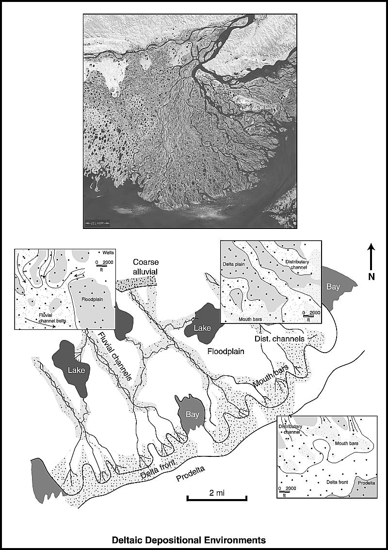
Photograph of the Lena delta, Russia. Courtesy of the NASA Web site (www.earthasart.gsfc.nasa.gov). The delta is about 200 km (124 mi) across in this view. The photograph has been rotated such that north faces down the page. The lower diagram is a lithofacies map of the basal Ivishak Formation, Prudhoe Bay field, Alaska (from Tye et al., 1999). Reprinted with permission from AAPG. From Shepherd, M., 2009, Deltaic reservoirs, in M. Shepherd, Oil field production geology: AAPG Memoir 91, p. 279-288.
File history
Click on a date/time to view the file as it appeared at that time.
| Date/Time | Thumbnail | Dimensions | User | Comment | |
|---|---|---|---|---|---|
| current | 20:10, 12 August 2015 | | 800 × 1,134 (191 KB) | Molyneux (talk | contribs) | Photograph of the Lena delta, Russia. Courtesy of the NASA Web site (www.earthasart.gsfc.nasa.gov). The delta is about 200 km (124 mi) across in this view. The photograph has been rotated such that north faces down the page. The lower diagram is a lith... |
You cannot overwrite this file.
File usage
The following page uses this file: