File:Seismic-inversion fig4.png
Jump to navigation
Jump to search

Size of this preview: 800 × 439 pixels. Other resolutions: 320 × 175 pixels | 841 × 461 pixels.
Original file (841 × 461 pixels, file size: 31 KB, MIME type: image/png)
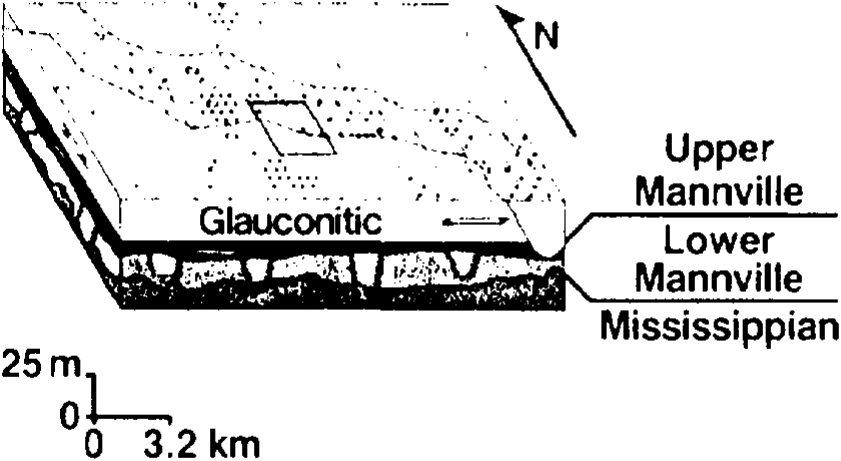
Copyright of: the Taber area of southern Alberta. The 3-D survey was done in the area outlined by the rectangle in the center of the map. (Courtesy of Western Geophysical
A schematic diagram of a river channel zone. Copyright: the Taber area of southern Alberta. The 3-D survey was done in the area outlined by the rectangle in the center of the map. (Courtesy of Western Geophysical.
File history
Click on a date/time to view the file as it appeared at that time.
| Date/Time | Thumbnail | Dimensions | User | Comment | |
|---|---|---|---|---|---|
| current | 19:34, 14 January 2014 | | 841 × 461 (31 KB) | Importer (talk | contribs) | {{copyright|the Taber area of southern Alberta. The 3-D survey was done in the area outlined by the rectangle in the center of the map. (Courtesy of Western Geophysical}} A schematic diagram of a river channel zone. Copyright: the Taber area of southe... |
You cannot overwrite this file.
File usage
The following page uses this file: