File:Seismic-inversion fig5.png
Revision as of 19:34, 14 January 2014 by Importer (talk | contribs) ({{copyright|Western Geophysical}} The model-based inversion of the line through the river channel system of Figure 4. Copyright: Western Geophysical. Category:Geophysical methods)

Size of this preview: 799 × 350 pixels. Other resolutions: 320 × 140 pixels | 2,036 × 892 pixels.
Original file (2,036 × 892 pixels, file size: 1.01 MB, MIME type: image/png)
Copyright of: Western Geophysical
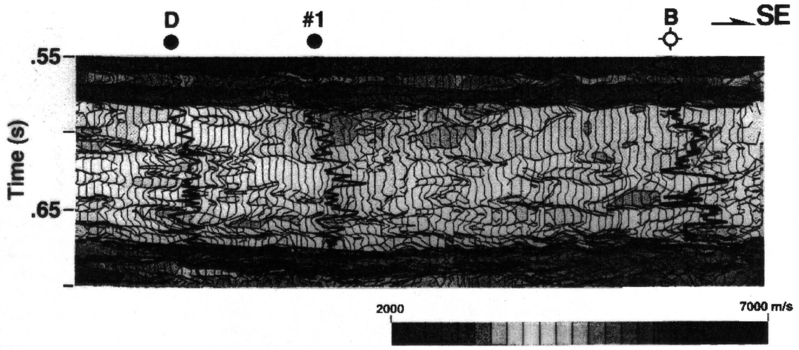
The model-based inversion of the line through the river channel system of Figure 4. Copyright: Western Geophysical.
File history
Click on a date/time to view the file as it appeared at that time.
| Date/Time | Thumbnail | Dimensions | User | Comment | |
|---|---|---|---|---|---|
| current | 19:34, 14 January 2014 | | 2,036 × 892 (1.01 MB) | Importer (talk | contribs) | {{copyright|Western Geophysical}} The model-based inversion of the line through the river channel system of Figure 4. Copyright: Western Geophysical. Category:Geophysical methods |
You cannot overwrite this file.
File usage
The following page uses this file: