File:USGSgashydratemap014.jpg
Jump to navigation
Jump to search
No higher resolution available.
USGSgashydratemap014.jpg (466 × 377 pixels, file size: 34 KB, MIME type: image/jpeg)
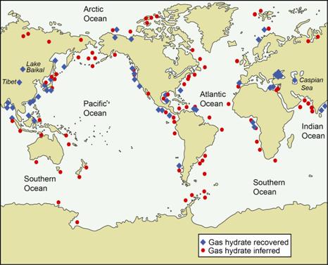
Known and inferred locations of gas hydrate occurrence. Map compiled by the USGS.
File history
Click on a date/time to view the file as it appeared at that time.
| Date/Time | Thumbnail | Dimensions | User | Comment | |
|---|---|---|---|---|---|
| current | 18:12, 24 June 2014 | | 466 × 377 (34 KB) | Molyneux (talk | contribs) | Known and inferred locations of gas hydrate occurrence. Map compiled by the USGS. |
You cannot overwrite this file.
File usage
The following page uses this file: