File:Figure3AustinChalk2019-20CommRept.jpg
Jump to navigation
Jump to search

Size of this preview: 800 × 496 pixels. Other resolutions: 320 × 199 pixels | 1,789 × 1,110 pixels.
Original file (1,789 × 1,110 pixels, file size: 895 KB, MIME type: image/jpeg)
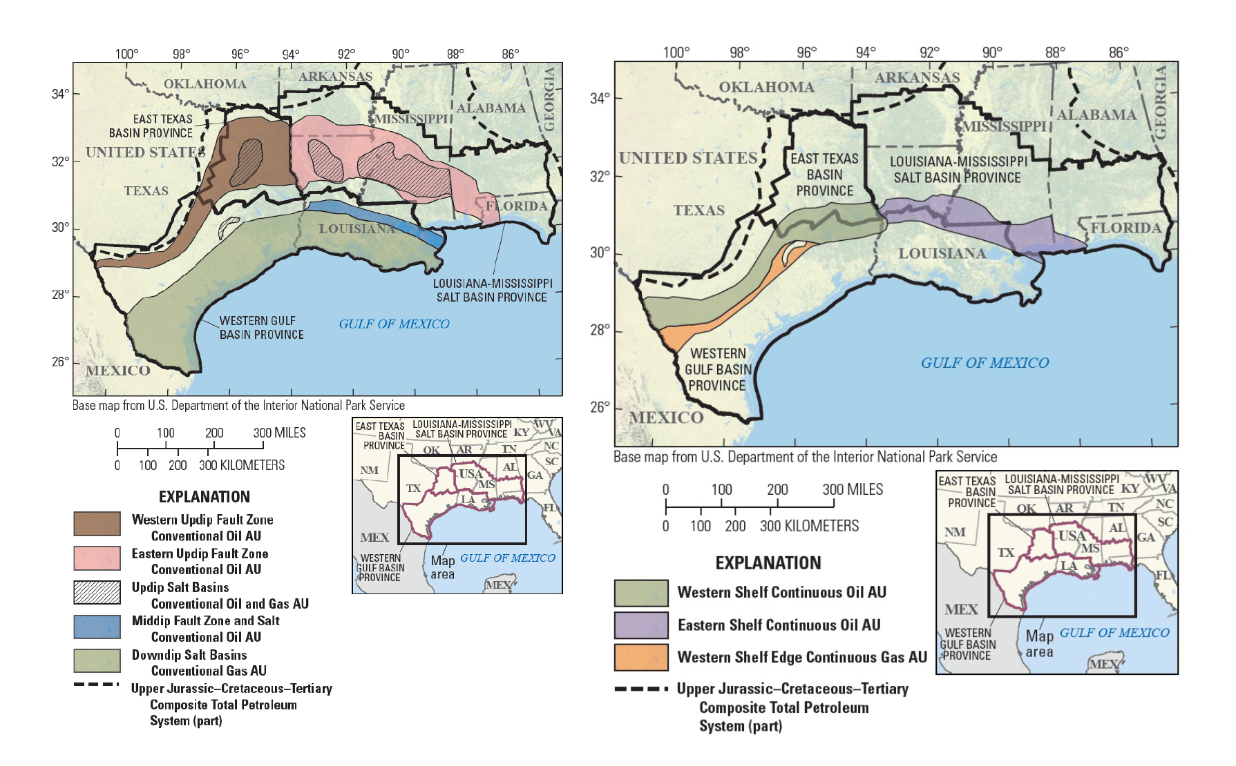
Conventional (left) and continuous (right) assessment unit boundaries determined as part of the 2019 USGS assessment of undiscovered, technically recoverable oil and gas resources in the Austin Chalk and related units in Texas and Louisiana. (Pitman et al., 2020).
File history
Click on a date/time to view the file as it appeared at that time.
| Date/Time | Thumbnail | Dimensions | User | Comment | |
|---|---|---|---|---|---|
| current | 21:21, 5 April 2021 | | 1,789 × 1,110 (895 KB) | Molyneux (talk | contribs) | Conventional (left) and continuous (right) assessment unit boundaries determined as part of the 2019 USGS assessment of undiscovered, technically recoverable oil and gas resources in the Austin Chalk and related units in Texas and Louisiana. (Pitman et... |
You cannot overwrite this file.
File usage
The following page uses this file: