File:M114CH08FG01.jpg
Jump to navigation
Jump to search
No higher resolution available.
M114CH08FG01.jpg (659 × 486 pixels, file size: 100 KB, MIME type: image/jpeg)
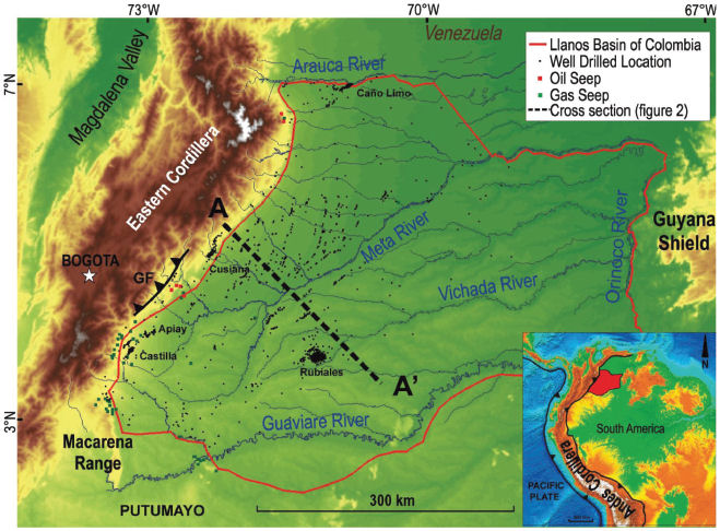
The bottom right insert presents the eastern forelands of the northern Andes in Colombia, the so-called Llanos Basin. The main map shows the topography, the fluvial system, the oil and gas seep occurrence, and the drilled well location. From AAPG Memoir 114: Petroleum Systems Analysis—Case Studies, [Chapter 08].
File history
Click on a date/time to view the file as it appeared at that time.
| Date/Time | Thumbnail | Dimensions | User | Comment | |
|---|---|---|---|---|---|
| current | 18:08, 7 January 2019 | | 659 × 486 (100 KB) | Molyneux (talk | contribs) | The bottom right insert presents the eastern forelands of the northern Andes in Colombia, the so-called Llanos Basin. The main map shows the topography, the fluvial system, the oil and gas seep occurrence, and the drilled well location. From AAPG Memoi... |
You cannot overwrite this file.
File usage
The following page uses this file: