File:Using-and-improving-surface-models-built-by-computer fig15.png
Jump to navigation
Jump to search

Size of this preview: 800 × 424 pixels. Other resolutions: 320 × 170 pixels | 926 × 491 pixels.
Original file (926 × 491 pixels, file size: 27 KB, MIME type: image/png)
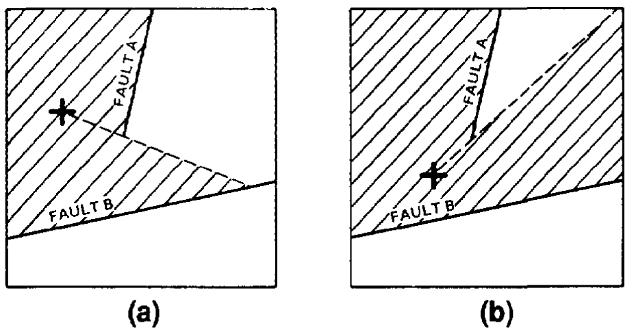
Faults act as barriers beyond which data cannot be seen from the location for which a surface value is being calculated. (a) A grid node (indicated by +) to the west of fault A can only see data in the hatchured area. (b) A grid node farther to the south of fault A can see more data, thus the surface smoothly changes form around the fault ends. (After Jones et al., 1986.)
File history
Click on a date/time to view the file as it appeared at that time.
| Date/Time | Thumbnail | Dimensions | User | Comment | |
|---|---|---|---|---|---|
| current | 22:32, 13 January 2014 | | 926 × 491 (27 KB) | Importer (talk | contribs) | Faults act as barriers beyond which data cannot be seen from the location for which a surface value is being calculated. (a) A grid node (indicated by +) to the west of fault A can only see data in the hatchured area. (b) A grid node farther to the sou... |
You cannot overwrite this file.
File usage
The following page uses this file: