File:Using-and-improving-surface-models-built-by-computer fig17.png
Jump to navigation
Jump to search

Size of this preview: 429 × 600 pixels. Other resolutions: 172 × 240 pixels | 814 × 1,138 pixels.
Original file (814 × 1,138 pixels, file size: 24 KB, MIME type: image/png)
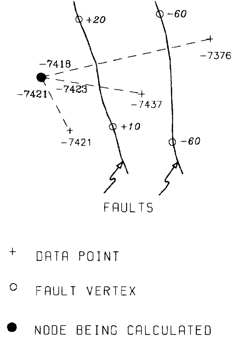
The data value is adjusted by the separation of faults crossed by the line connecting the data point and the location for which an estimate is being made.
File history
Click on a date/time to view the file as it appeared at that time.
| Date/Time | Thumbnail | Dimensions | User | Comment | |
|---|---|---|---|---|---|
| current | 22:32, 13 January 2014 | | 814 × 1,138 (24 KB) | Importer (talk | contribs) | The data value is adjusted by the separation of faults crossed by the line connecting the data point and the location for which an estimate is being made. Category:Integrated computer methods |
You cannot overwrite this file.
File usage
The following page uses this file: