File:H4CH12FG2.JPG
H4CH12FG2.JPG (800 × 581 pixels, file size: 246 KB, MIME type: image/jpeg)
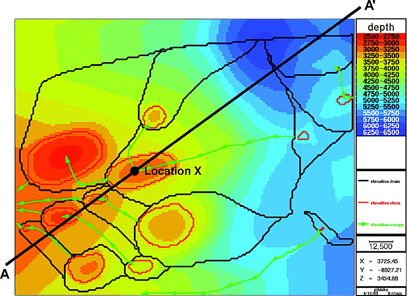
Present-day depth structure map (meters) of the key migration surface. The outlines of the drainage polygons are shown in black, the closures are outlined in red, and the escape paths are shown in green. The scale bar in the legend represents 12,500 m (41,010 ft). From Identifying and quantifying significant uncertainties in basin modeling, 2012, Hicks, P. J. Jr., C. M. Fraticelli, J. D. Shosa, M. J. Hardy, and M. B. Townsley, in Peters, Kenneth E., David J. Curry, and Marek Kacewicz, eds., Basin modeling: New horizons in research and applications: AAPG Hedberg Series no. 4, p. 207-219.
File history
Click on a date/time to view the file as it appeared at that time.
| Date/Time | Thumbnail | Dimensions | User | Comment | |
|---|---|---|---|---|---|
| current | 20:11, 9 July 2015 | | 800 × 581 (246 KB) | Molyneux (talk | contribs) | Present-day depth structure map (meters) of the key migration surface. The outlines of the drainage polygons are shown in black, the closures are outlined in red, and the escape paths are shown in green. The scale bar in the legend represents 12,500 m ... |
You cannot overwrite this file.
File usage
The following page uses this file: