File:M115CH10FG01.jpg
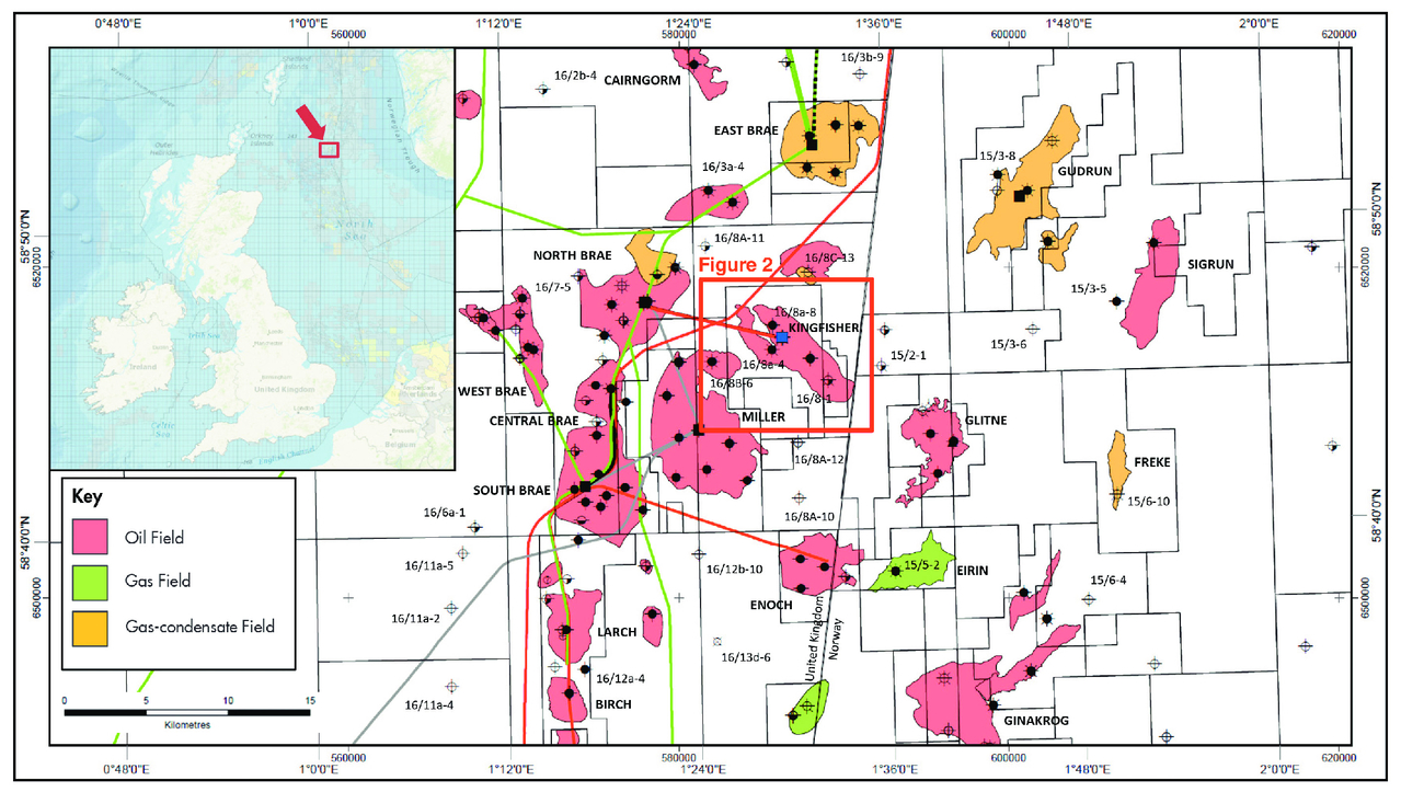
Revision as of 18:33, 17 January 2019 by Molyneux (talk | contribs) (Location map of the Kingfisher field in UKCS Blocks 16/8a and 16/8d showing the nearby producing Brae area fields and discoveries within the South Viking Graben. From AAPG Memoir 115—Rift-Related Coarse-Grained Submarine Fan Reservoirs: The Brae Play...)
Size of this preview: 800 × 452 pixels. Other resolutions: 320 × 181 pixels | 1,279 × 723 pixels.
Original file (1,279 × 723 pixels, file size: 781 KB, MIME type: image/jpeg)
Location map of the Kingfisher field in UKCS Blocks 16/8a and 16/8d showing the nearby producing Brae area fields and discoveries within the South Viking Graben. From AAPG Memoir 115—Rift-Related Coarse-Grained Submarine Fan Reservoirs: The Brae Play, South Viking Graben, North Sea, Chapter 10.
File history
Click on a date/time to view the file as it appeared at that time.
| Date/Time | Thumbnail | Dimensions | User | Comment | |
|---|---|---|---|---|---|
| current | 18:33, 17 January 2019 | | 1,279 × 723 (781 KB) | Molyneux (talk | contribs) | Location map of the Kingfisher field in UKCS Blocks 16/8a and 16/8d showing the nearby producing Brae area fields and discoveries within the South Viking Graben. From AAPG Memoir 115—Rift-Related Coarse-Grained Submarine Fan Reservoirs: The Brae Play... |
You cannot overwrite this file.
File usage
The following page uses this file: