File:M91Ch11FG73.JPG
Jump to navigation
Jump to search

Size of this preview: 650 × 600 pixels. Other resolutions: 260 × 240 pixels | 800 × 738 pixels.
Original file (800 × 738 pixels, file size: 128 KB, MIME type: image/jpeg)
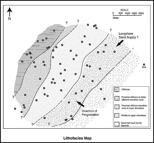
Lithofacies map for the upper Piper Sand interval of the Scott field, UK North Sea (from Guscott et al., 2003). Reprinted with permission from the Geological Society. From Shepherd, M., 2009, Lithofacies maps, in M. Shepherd, Oil field production geology: AAPG Memoir 91, p. 93-98.
File history
Click on a date/time to view the file as it appeared at that time.
| Date/Time | Thumbnail | Dimensions | User | Comment | |
|---|---|---|---|---|---|
| current | 15:54, 27 April 2015 | | 800 × 738 (128 KB) | Molyneux (talk | contribs) | Lithofacies map for the upper Piper Sand interval of the Scott field, UK North Sea (from Guscott et al., 2003). Reprinted with permission from the Geological Society. From Shepherd, M., 2009, Lithofacies maps, in M. Shepherd, Oil field production geolo... |
You cannot overwrite this file.
File usage
The following 2 pages use this file: