File:Magnetics fig1.png

Original file (2,677 × 1,649 pixels, file size: 34 KB, MIME type: image/png)
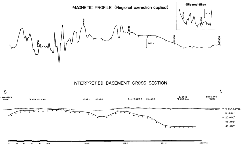
This long aeromagnetic profile from the Canadian Arctic islands illustrates the main use of aeromagnetics in petroleum exploration. Each small circle on the basement cross section shows a depth determined from the magnetic profile. At the south end, the magnetic anomalies are sharp over the shallow basement of Devon Island. Anomalies broaden over Jones Sound where the basement deepens and then become sharper as it rises again. The basin develops fully to the north, and minor sharp anomalies (shown on expanded scale) indicate dikes and sills within the sediments.
File history
Click on a date/time to view the file as it appeared at that time.
| Date/Time | Thumbnail | Dimensions | User | Comment | |
|---|---|---|---|---|---|
| current | 23:17, 14 January 2014 | | 2,677 × 1,649 (34 KB) | Importer (talk | contribs) | This long aeromagnetic profile from the Canadian Arctic islands illustrates the main use of aeromagnetics in petroleum exploration. Each small circle on the basement cross section shows a depth determined from the magnetic profile. At the south end, th... |
You cannot overwrite this file.
File usage
The following page uses this file: