Search results
Jump to navigation
Jump to search
Page title matches
- #REDIRECT [[Seismic data - creating an integrated structure map]]65 bytes (9 words) - 21:43, 8 May 2014
- Below is a recipe for making a classic integrated structure map from [[seismic data]] and well control. It is based on mappin # Contour the integrated structure map, keeping in mind the structure map made earlier from well dat7 KB (1,117 words) - 17:51, 25 January 2022
Page text matches
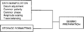
File:Two-dimensional-geophysical-workstation-interpretation-generic-problems-and-solutions fig2.png [[Category:Integrated computer methods]](936 × 370 (7 KB)) - 15:37, 14 January 2014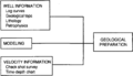
File:Two-dimensional-geophysical-workstation-interpretation-generic-problems-and-solutions fig3.png [[Category:Integrated computer methods]](936 × 542 (25 KB)) - 15:37, 14 January 2014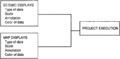
File:Two-dimensional-geophysical-workstation-interpretation-generic-problems-and-solutions fig4.png [[Category:Integrated computer methods]](926 × 454 (17 KB)) - 15:37, 14 January 2014- #REDIRECT [[Seismic data - creating an integrated structure map]]65 bytes (9 words) - 21:43, 8 May 2014
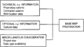
File:Two-dimensional-geophysical-workstation-interpretation-generic-problems-and-solutions fig1.png [[Category:Integrated computer methods]](937 × 522 (9 KB)) - 15:37, 14 January 2014
File:Using-and-improving-surface-models-built-by-computer fig11.png [[Category:Integrated computer methods]](951 × 878 (13 KB)) - 22:32, 13 January 2014
File:Two-dimensional-geophysical-workstation-interpretation-generic-problems-and-solutions fig5.png [[Category:Integrated computer methods]](940 × 2,048 (73 KB)) - 15:37, 14 January 2014
File:Introduction-to-contouring-geological-data-with-a-computer fig2.png [[Category:Integrated computer methods]](942 × 932 (23 KB)) - 22:06, 13 January 2014
File:Introduction-to-contouring-geological-data-with-a-computer fig3.png [[Category:Integrated computer methods]](948 × 938 (21 KB)) - 22:06, 13 January 2014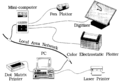
File:A-development-geology-workstation fig1.png [[Category:Integrated computer methods]](1,913 × 1,312 (134 KB)) - 15:34, 14 January 2014
File:Introduction-to-contouring-geological-data-with-a-computer fig1.png [[Category:Integrated computer methods]](947 × 524 (13 KB)) - 22:06, 13 January 2014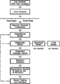
File:Evaluating-diagenetically-complex-reservoirs fig2.png Stages In the generation of an Integrated geological reservoir model.(950 × 1,324 (52 KB)) - 18:46, 14 January 2014
File:Introduction-to-contouring-geological-data-with-a-computer fig5.png [[Category:Integrated computer methods]](943 × 946 (63 KB)) - 22:06, 13 January 2014
File:Using-and-improving-surface-models-built-by-computer fig8.png [[Category:Integrated computer methods]](837 × 343 (9 KB)) - 22:32, 13 January 2014
File:Using-and-improving-surface-models-built-by-computer fig2.png [[Category:Integrated computer methods]](810 × 438 (18 KB)) - 22:32, 13 January 2014
File:Log-analysis-applications fig1.png [[Category:Integrated computer methods]](936 × 971 (14 KB)) - 16:36, 14 January 2014
File:Introduction-to-contouring-geological-data-with-a-computer fig4.png [[Category:Integrated computer methods]](942 × 1,209 (53 KB)) - 22:06, 13 January 2014
File:Using-and-improving-surface-models-built-by-computer fig21.png [[Category:Integrated computer methods]](881 × 484 (19 KB)) - 22:33, 13 January 2014
File:Using-and-improving-surface-models-built-by-computer fig1.png [[Category:Integrated computer methods]](923 × 479 (31 KB)) - 22:32, 13 January 2014
File:Introduction-to-contouring-geological-data-with-a-computer fig6.png [[Category:Integrated computer methods]](947 × 957 (42 KB)) - 22:06, 13 January 2014


