Search results
Jump to navigation
Jump to search
Page title matches
File:3D Seismic.jpeg (918 × 553 (247 KB)) - 02:11, 24 June 2015

Page text matches
File:AlHawajAlQahtaniFigure5.jpg Schematic 3D geometry of salt structures rising from a) line sources and b) point source(475 × 311 (57 KB)) - 21:01, 8 November 2021
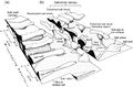
File:AlHawajAlQahtaniFigure1.jpg 3D restoration conducted on a faulted and folded layer (Sub-Andean Zone, Boliv(979 × 447 (95 KB)) - 20:44, 8 November 2021- [[File:Fixed gulf map.png|thumb|500px|The Gulf of Mexico in 3D perspective. NOAA]]289 bytes (42 words) - 16:12, 26 February 2016
- [[File:3D Seismic.jpeg|300px|thumbnail|left|{{figure number|3}}3-D Seismic]] Surveying in three dimensions ([[:File:3D Seismic.jpeg|Figure 3]]), registers the sources and receptors ubicates acro5 KB (708 words) - 22:00, 10 April 2019
- ..., B., A., Stampfli, G., M., 1994, Sequence stratigraphic interpretation of 3D seismic data offshore Louisiana—a case study: First Break, vol. 12, no. 96 KB (859 words) - 19:42, 27 January 2022
- ....<ref name=ch10r81>Stephenson, M., J. Cox, and P. Jones-Fuentes, 1992, How 3D seismic-CAEX combination affected development of N. Frisco City field in Al4 KB (556 words) - 20:56, 31 March 2022
- ...orettietal_2006>Moretti, I., F. Lepage, and M. Guiton, 2006, KINE3D: A new 3D restoration method based on a mixed approach linking geometry and geomechan Structural restoration can be conducted in 2-D and 3D models. As 3-D applications help to quantify spatial distribution of deform17 KB (2,335 words) - 17:14, 13 October 2022
- ...J. A. Cartwright, S. A. Stewart, S. A. Lappin, and J. R. Underhill, eds., 3D seismic technology, applications to the exploration of sedimentary basins: ...fred, 1991, Attribute extraction: An important application in any detailed 3D interpretation study: Leading Edge, v. 10, no. 9, p. 11–19.</ref> <ref na21 KB (3,139 words) - 16:54, 6 April 2016
- ...> Belt and Rice<ref name=ch18r8>Belt, J., Q., Rice, G., K., 1996, Offshore 3D seismic, geochemical data integration, Main Pass project, Gulf of Mexico: O8 KB (1,128 words) - 22:24, 31 January 2022
- ...e Belt and Rice<ref name=ch18r8>Belt, J., Q., Rice, G., K., 1996, Offshore 3D seismic, geochemical data integration, Main Pass project, Gulf of Mexico: O8 KB (1,055 words) - 16:29, 25 January 2022
- ...in characterizing reservoirs in Deep-water Niger Delta. In addition, from 3D seismic data, one of the main attributes is to extract the seismic facies a ...0/segam2020-3426105.1</ref> agree, in order to achieve that goal, first, a 3D seismic survey that has been acquired in the new field must be interpreted.21 KB (3,096 words) - 20:59, 21 April 2022
- ...png|400px|thumbnail|center|Figure 8 Kind of DHI.<ref>Bacon et.all. (2003). 3D Seismic Interpretation, Cambridge University Press. P.126</ref>]]8 KB (1,264 words) - 16:41, 30 June 2015
- ...center|Figure 8 Kind of DHI.<ref>Bacon, M., R. Simm, and T. Redshaw, 2003, 3D Seismic Interpretation. Cambridge University Press, p. 126</ref>]]8 KB (1,291 words) - 15:49, 18 January 2017
- ...son, J. C., Steer, B., Garing J., Osborne, G., Gad, A., and Amr, H., 1997, 3D seismic and workstation technology brings technical revolution to the Gulf8 KB (1,093 words) - 21:21, 3 February 2022
- ...J. A. Cartwright, S. A. Stewart, S. A. Lappin, and J. R. Underhill, eds., 3D seismic technology, applications to the exploration of sedimentary basins:20 KB (2,850 words) - 15:33, 15 January 2024
- ...ells are drilled and prepared for producting the oil. For optimal recovery 3D seismic is usually available and it can mapped the subsurface area. After p15 KB (2,331 words) - 19:12, 17 April 2019
- ...d sea-floor imaging techniques, coupled correlating seismic anomalies from 3D mapping with core and well logging data reveals the depositional geometry a13 KB (1,889 words) - 19:11, 6 April 2016
- ...bon volumes in stratigraphic traps increased to 15%, driven by advances in 3D seismic imaging.<ref name=Halbouty_2003>Halbouty, M. T., 2003, Giant oil an ...tion of rock properties.<ref name=Fryklundandstark_2020 /> High resolution 3D seismic volume and seismic imaging data results in more detailed maps, impr27 KB (3,791 words) - 19:35, 11 October 2022
- ...field, Gulf of Suez, Egypt, using SCAT, isogon-based section and maps, and 3D seismic: The Leading Edge, vol. 16, p. 1143–1150, DOI: [http://library.se14 KB (2,128 words) - 17:25, 18 January 2022
- ...2000, [http://www.sciencedirect.com/science/article/pii/S026481720000026X 3D seismic study of a shale expulsion syncline at the base of the Champion Del17 KB (2,466 words) - 16:16, 10 January 2024

